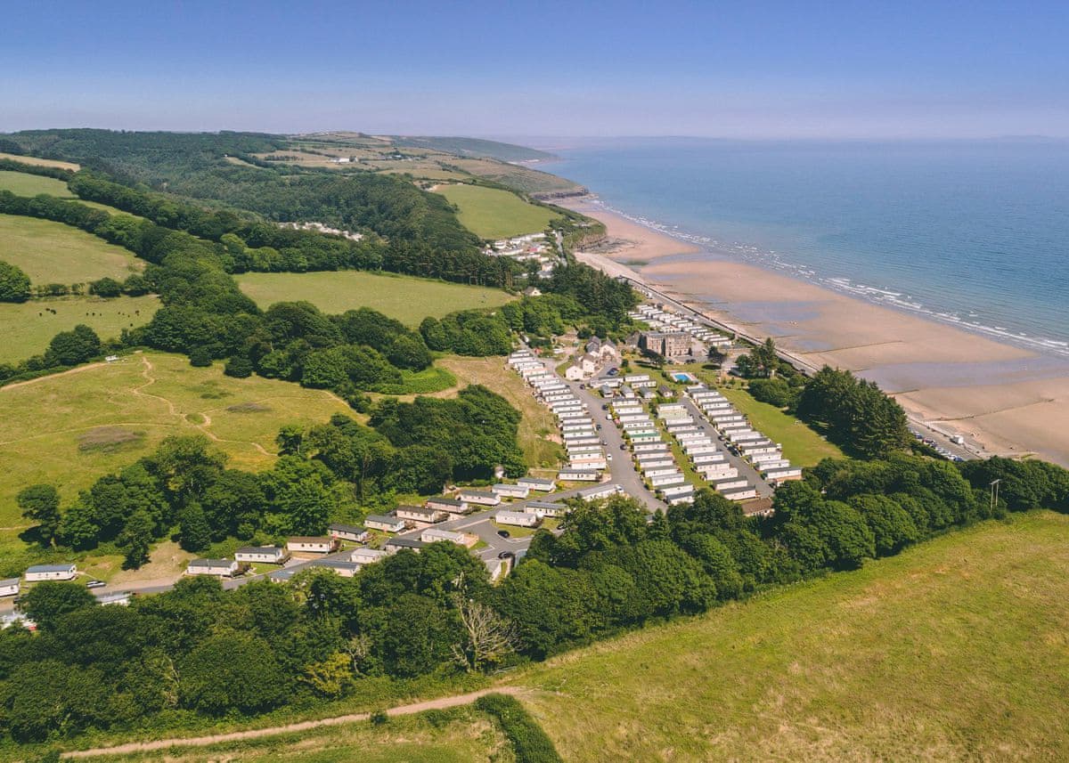
Wisemans Bridge, SA69 9AU
Beachfront pub between Saundersfoot and Amroth with a garden that runs down to the sand, real ales, eight B&B rooms and a small touring park — open 365 days a year.
- Phone
- +44 1834 813236
- Website
- wisemansbridgeinn.co.uk
The quiet middle beach on the Amroth–Saundersfoot tramway walk: pebbles at the top, wide firm sand below, pub on the sea front.
Wiseman's Bridge sits between Amroth and Saundersfoot, and most people meet it halfway along the old tramway path that links the three. It's a low-key place — a row of houses, a car park, an inn facing the sea — with a beach that's steep shingle at high water and opens into a long, flat, firm sand at low tide that joins up with Amroth's in one direction and Coppet Hall's through the tunnels in the other.
That tramway path is the reason to base a day here. It's flat, surfaced, and runs on the bed of the old colliery tramroad through lit tunnels cut in the cliff — the best easy walk in south Pembrokeshire and fine with a pushchair or a bike. Amroth is fifteen minutes east, Coppet Hall and Saundersfoot twenty-odd minutes west. Doing it as a pub-to-pub walk on a falling tide, with the sand as the return route, is a properly good afternoon.
In 1943 this beach was used for large-scale D-Day landing rehearsals, and Churchill is generally said to have watched them from here; a plaque on the sea front records it. Swimming is unguarded and the shingle shelves quite steeply near high water, so families with small children are better off timing the visit for the bottom of the tide when there's an acre of flat sand and shallow water. Parking is limited and fills up on hot days.
The nearest pubs, cafés and restaurants, closest first. Walking times are rough estimates on lane and cliff path — check opening hours before you rely on one.
Wisemans Bridge, SA69 9AU
Beachfront pub between Saundersfoot and Amroth with a garden that runs down to the sand, real ales, eight B&B rooms and a small touring park — open 365 days a year.
900m away · about 15 min walk
1.1km away · about 15 min walk
Amroth seafront, Amroth, SA67 8NF
Seafront café on Amroth's front, where the Coast Path begins.
1.1km away · about 15 min walk
1.2km away · about 20 min walk
Saundersfoot, SA69 9AJ
1.7km away · about 25 min walk
Nearest forecast point: Tenby
dry for the next few hours, around 12°C, gusting to 26 mph — hold on to the windbreak.
01:00
12°
Clear
W 26 mph
02:00
12°
Clear
W 25 mph
03:00
12°
Clear
W 25 mph
04:00
12°
Clear
W 23 mph
05:00
12°
Clear
W 23 mph
06:00
12°
Clear
W 23 mph
07:00
11°
Clear
W 22 mph
08:00
11°
Clear
NW 23 mph
Forecast from MET Norway, used under CC BY 4.0. It's a forecast for the nearest of six points across the county, not for this exact spot — on a coast this shaped, one headland can be in sun and the next in rain.
The light goes gold from about 17:55.
Calculated for these coordinates, accurate to a minute or so. A cliff or a headland to your west will take the sun sooner than this suggests.
Tenby · about 4 miles away
High water
06:30
Sat 10 Oct · 8.4m
Low water
12:41
Sat 10 Oct · 0.9m
High water
18:47
Sat 10 Oct · 8.6m
Low water
01:03
Sun 11 Oct · 0.9m
Predicted times from the UK Hydrographic Office. Wind and pressure shift real water levels, and the tide at a specific cove can run earlier or later than its port. Never plan a tidal crossing on this alone.
Natural Resources Wales
NRW notes water quality here can be affected by heavy rain — worth remembering the day after a downpour.
This is a designated bathing water, sampled by Natural Resources Wales through the May–September season. Official record (Open Government Licence v3.0, © Natural Resources Wales). Classification as published when we last checked, 2026-08-21 — the official record always has the latest.
The practical answers, from the people responsible for them, checked 2026-08-23.
Wiseman's Bridge is not on the RNLI’s list of patrolled beaches, so there is no lifeguard service at any time of year. Judge the water yourself, and if you are at all unsure, swim somewhere that is patrolled.
Source: RNLI, 2026 patrol dates
Concrete ramp, 1:6 easing to 1:4½ over 23 metres — steep at the top.
Source: Pembrokeshire Coast National Park Authority, Easy Access Beaches
OpenStreetMap
2 car parks within a mile of the sand, 1 of them free. The nearest is about 1.0km (0.6 miles) away — roughly a 15-minute walk if you park there and carry everything in.
Unnamed car park, Wiseman's Bridge
Free
Unnamed car park, Amroth
Charges apply
All parking around Wiseman's Bridge →
Distances are straight-line from the beach, so the walk is usually longer — and on this coast it is often downhill on the way there. Charges and space counts come from OpenStreetMap contributors and can go out of date; we don’t print prices, because the map records whether a car park charges, not how much. In July and August the popular ones fill by mid-morning.
No reviews yet — been to Wiseman's Bridge? Tell people what it was actually like.
Dogs welcome all year — this beach carries no seasonal restriction under Pembrokeshire County Council's summer beach bans.
The nearest car park we map is Car park, about 1.0km (0.6 miles) away (free). There is one more within a mile.
We don't have public toilets mapped within a mile of Wiseman's Bridge. Assume there are none and plan around it.
Answers are generated from what we actually hold in our database and refreshed as it changes. Opening hours, dog rules and prices move — check with the venue before you travel.
Hand-picked places to stay within a mile or so, nearest first. Our picks are data-driven — we haven’t stayed — and we earn a commission when you book through a partner link. How that works.

Amroth · Sleeps 6 · 3 beds
Bookable via holidaycottages.co.uk
Saundersfoot · Sleeps 6 · 3 beds
Bookable via holidaycottages.co.uk

Amroth · Sleeps 8
3.0 · 3 reviews on Hoseasons
Bookable via Hoseasons